The most trying experience of our whole trip happened on Santa Cruz Island. An adventure we’ll never forget.
Cruising the California coast wouldn’t be complete without visiting the islands. We started the morning checking current weather conditions around Santa Cruz Island and all looked good for our planned cruise. After topping off the water we said goodbye to our hosts and cast off.

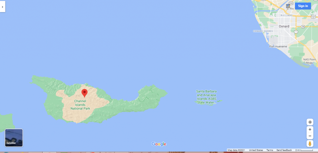
It is a short cruise, about 15 miles to the island. One of the unique attractions is the numerous water caves. Our first anchorage, Big Scorpion, provided pretty good protection from surge and a few interesting water cave features.
Santa Cruz Island is far different than Catalina Island.
We had some idea what what anchorages were like from descriptions in Charlie’s Charts. But we didn’t know what it would actually be like anchoring and spending time at the island. As it turns out our first choice, Little Scorpion is not a very attractive or interesting place. We ended up anchoring at Big Scorpion where there was better protection from surge and more interesting attractions on shore.


This is a rugged island with little or no infrastructure. If you need something you will have to bring it with you.
Exploring Santa Cruz Island, CA
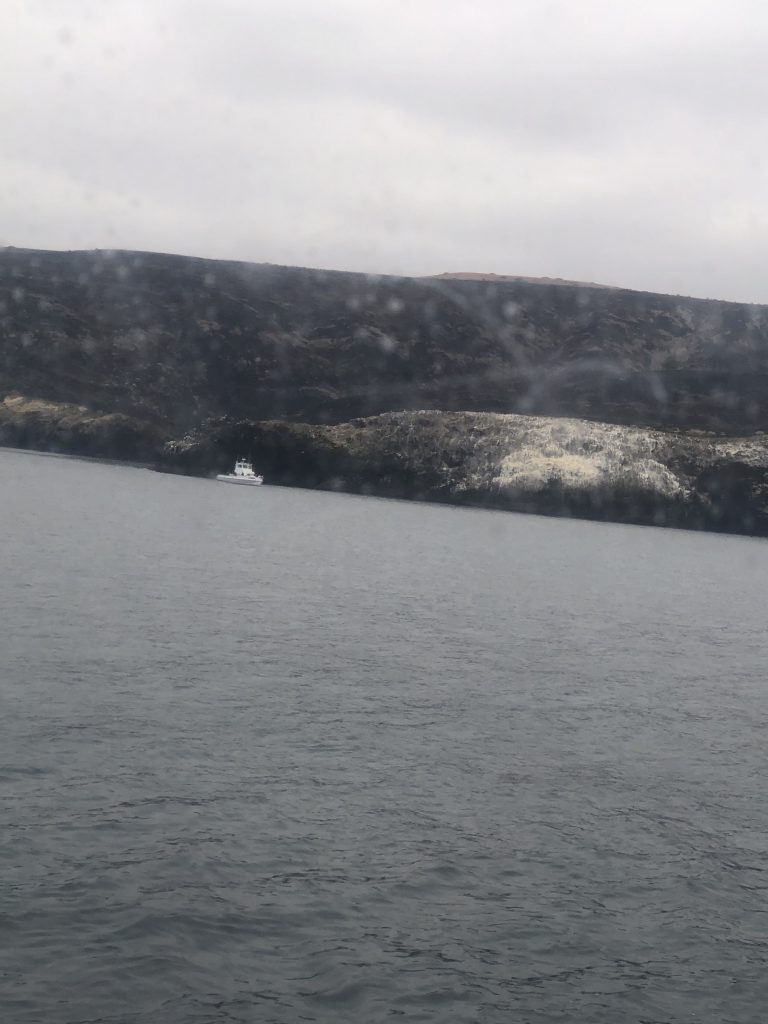
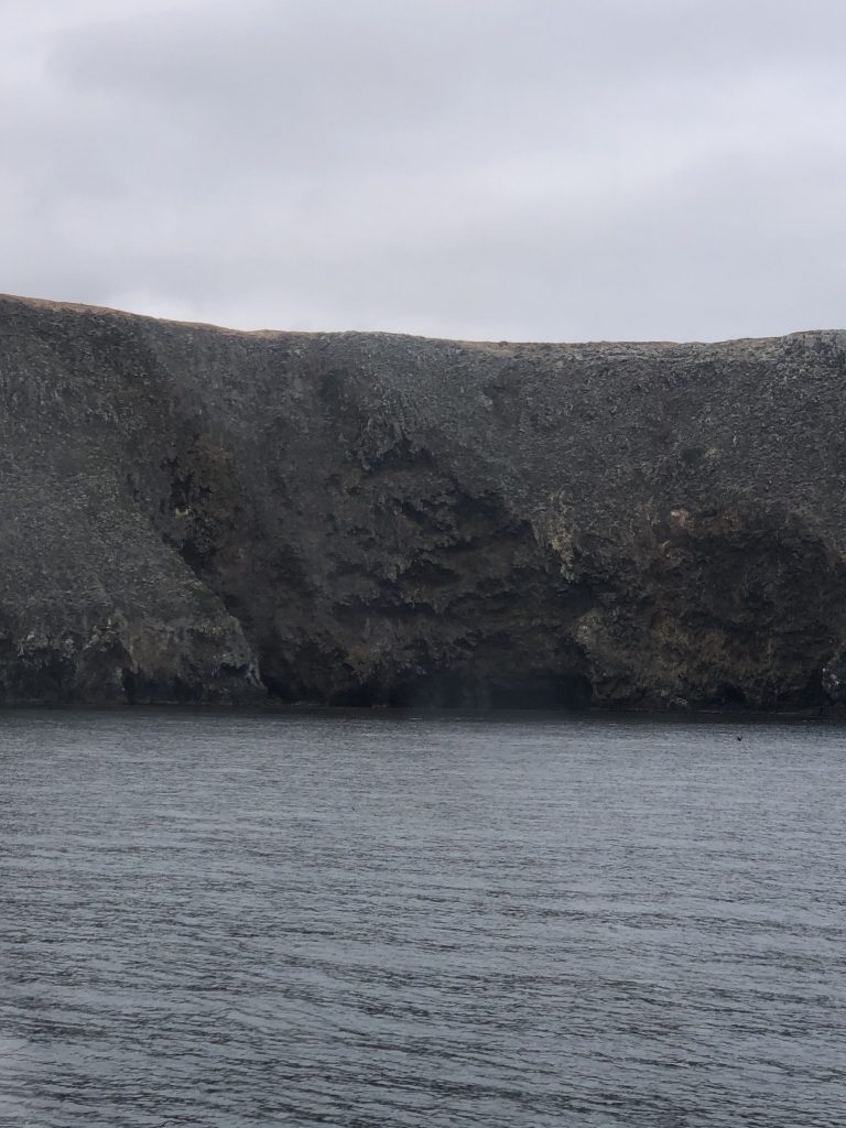
This island would be a pirate’s dream. The caves are all at the water line. Some are shallow but some are large enough to run your dinghy or kayak into. A great place to hide out or hide your treasure!
This is a rocky island with a lot of relatively soft volcanic rock. The water is warm enough to swim and clear enough to see about 20 to 30 feet.
A typical morning in southern California during the month of June. It’s called “June Gloom”. Like clockwork the fog predominates the weather throughout the month. It usually clears for a while in the late morning or early afternoon and is back in late afternoon. This factor should be taken into account when planning a trip anywhere along the southern California coast.
Exploring Water Caves on Santa Cruz Island
Water caves are the big attraction and can be found just about everywhere. In the video below we explore one of those caves on foot.
After our excursion exploring caves at Big Scorpion we headed west along the coast to an awesome little cove where we planned to spend a day or two. The weather was perfect for the short trip. This was a very scenic spot and we were the only boat there. Perfect hideaway!
The Weather Turns Against Us
After a couple beautiful days at the island and spending a few hours in an idyllic little hideaway where we planned to spend the night and maybe make a trip ashore everything suddenly changed. Our little cove was quickly becoming a trap. Wind was picking up and the surge was beginning to pour directly into the cove.
The waves were growing and my concern was that if conditions worsened this pretty little cove would become a trap. If our anchor let go even for a minute we would be swept onto the nearby rocks. The time it would take to start the engines and reset the anchor it would be too late. We made the decision to get the hell out of there and seek a safer refuge.
By the time we started the engines and began weighing anchor the rollers were already topping four feet. Getting the anchor up was challenging but with the first mate at the helm and me at the windless we managed to hold our position and accomplish the task.
We broke out of the cove and into the open sea. I felt safer but knew we had to find someplace to shield us from the growing seas. It was getting too windy and rough to make a run for the mainland.
Considering wind direction and wave conditions we needed to find a refuge near our position. No anchorage on the north side of the island would be protected from the northwest wind and surge. Checking maps and charts as we headed into the rising sea I found a possible refuge.

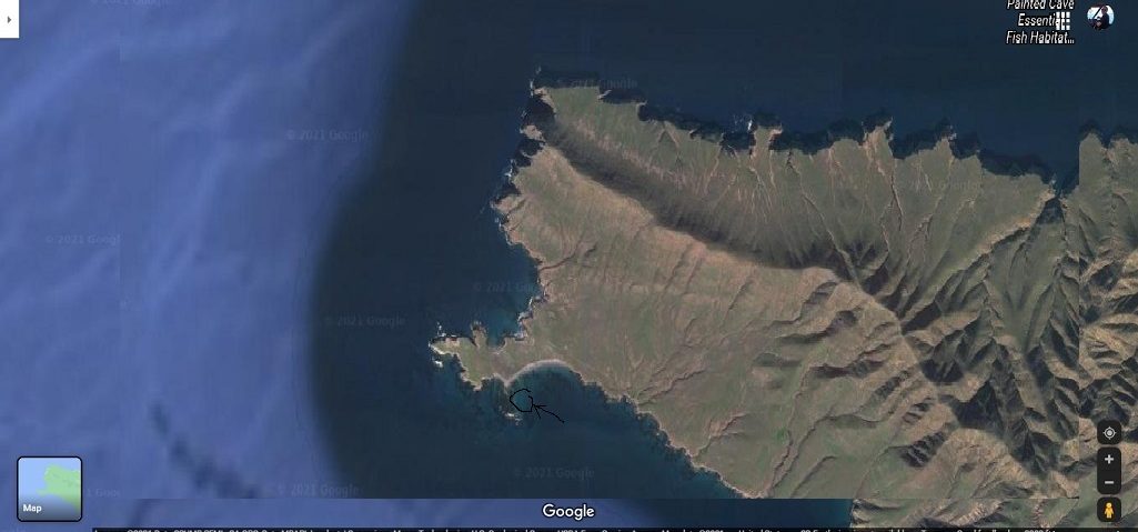
There appeared to be a protected spot at the west end on the south side of the island. It was the closest spot we could reach in the least amount of time.
Safe Harbor-Forney Cove
By the time we rounded the west end of the island the wind was 25 to 30, gusting to 40. Seas were 10 to 15 feet. It turns out we made a good choice. Forney Cove offered great protection from sea. All we had to deal with now was the wind.
We pulled up as close to shore as we dared. The water was about 20 feet deep. We let out 100 feet of chain and another 100 feet of rode. It was mid afternoon when we settled down for the day. We were both monitoring our position.
We made it through the night. The next morning seemed calmer. We decided to take a dinghy to shore. We navigated around kelp and rock and finally got right up to the beach when a wave upended our dinghy and dumped us both on the beach. Our vests inflated as we sat there staring at each other and broke out into laughter.
This was a beautiful, desolate beach and at any other time would have been a great place to hang out. We spent about one half hour looking for shells and checking sea conditions on the other side of the rock barrier. We both realized the wind was picking up again and if we were going to get back to Mai Tai we better get going quick.
The wind continued to pick up as the afternoon went on. The anchor rode was tight as a banjo string. At one point the anchor let go and we were drifting. Luckily we had plenty of leeway behind us. Unfortunately the anchor caught again and jerked the bow around so hard it bent the bow roller bracket.
We fired up the engines and proceeded to try to raising the anchor. This was no easy task but we finally got it up, moved back up into the pocket and reset the anchor. This time putting out 300 feet of chain and rode. And here we sat until the next morning.
If we were to make a run for the mainland we would have to do it early the next morning. Before the wind got up to full strength. The closest port on the mainland was Santa Bárbara.
To start at the beginning of our journey Click Here.
Hello! Nice recant of your journey and thank you for documenting it. I’m sure I’ve simply not found it, but I don’t see any reference to your boat or who you are. I’m bringing a recent purchase – 2004 Regal 4260 – from Alameda to SD Bay next month and wanted to compare your path and time to my expectations.
Hi Brian,
Thanks for your comments. As far as the “who I am” question I hold no special creds. I have been a boat owner for more than 25 years. Most of that time for pleasure and recreation. A few years ago I began spending more time sailing with die-hard cruiser friends on their boats. I gained a lot of confidence which lead to cruising my own boat, a 35′ aft cabin cruiser.
Our journey from San Diego to San Francisco started May 17th and ended July 23, 2020. We stopped at many of the ports along the way and visited two of the Channel Islands.
Peak seasons are pretty much what you would expect. Summer being the busiest and winter being the slowest. Although, in So. Cal. spring and fall can be very busy, too. Because of the size of your boat it would be prudent to check with the dock masters of your intended ports of call to check availability for transient space. Making reservations can be challenging due to weather and sea conditions.
Although our cruising this year will be limited to the Bay and Delta I do have plans for a San Diego to Santa Barbara cruise on a friends boat later this year.
I know you are going to love ocean cruising and if you ever have questions or just want to chat I check in with me any time.