The dreaded cruise from Santa Barbara to Morro Bay, around Point Conception
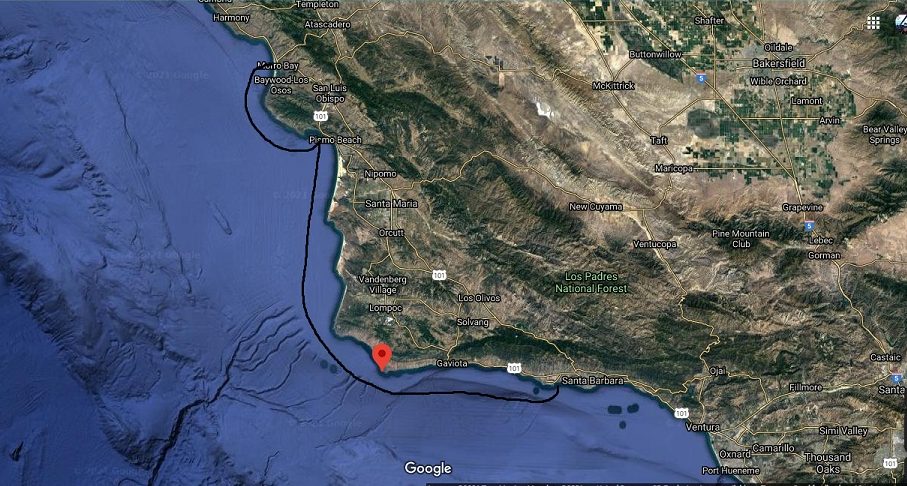
Cruising the California Coast has a few areas famous for unpredictable and rough seas. One of those areas is Point Conception, sometimes called California’s Cape Horn. On this leg of our cruise, from Santa Barbara to Morro Bay we are confronted with the prospect of encountering the roughest seas of our journey.
This will also be one of the longest legs of our journey through the most desolate rugged coast line. There will be long periods of isolation where communications with others is doubtful. That meant we’d be on our own for much of the time.
Decision Time
We stayed in Santa Barbara about two weeks. We waited for and finally received our new inflatable, were rested and getting anxious to head out to sea.
We were monitoring the weather and sea conditions along our planned route for days trying to get an understanding of the patterns. The last thing we wanted was to run into high winds and challenging seas for what would be our longest leg of the trip. There are many stories of boats getting into trouble because of unexpected weather changes.
Taking the time to compare forecasts with actual conditions proved very helpful. We saw an opportunity to cast off coming. We moved Mai Tai from the harbor out to the anchorage and waited.
Early Morning Departure From Santa Barbara
Up before daybreak and ready to weigh anchor. Wind and sea forecasts looked ideal. Mai Tai is ship shape. We are rested and anxious. We left very early hoping to be around the point before afternoon. Wind and sea conditions were forecast to be favorable but we also observed that wind velocity usually picks up in this area later in the day.
We fired up both nav stations, reviewed our course and fired the engines. It was still dark and would be for a couple hours. If things turned south on us before rounding Point Conception we could always stop off at Cojo Point anchorage a few miles East.
Changing Environment Between Santa Barbara and Morro Bay
It is amazing how the weather and sea change at Point Conception. We were not only leaving Southern California. We were entering an entirely new atmosphere. The climate was notably different. The coastline was baron and rugged.
We were not alone as I thought we would be. There were a few small fishing boats. An occasional sailboat and once in a while a motor cruiser would pass. If we ran into trouble there would be someone within radio range. But, even these passersby would be far and few between once we rounded the point.
Rounding Point Conception
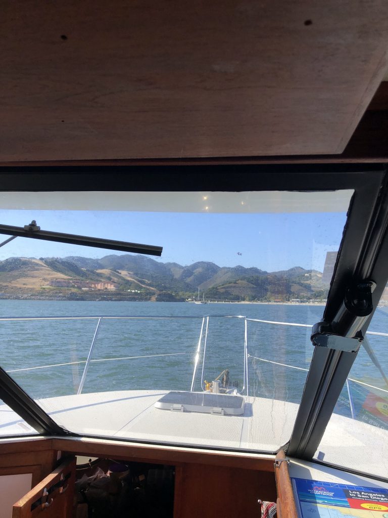
As we approached Point Conception swells began to increase in size between 4 and 8 feet but frequency between waves remained low. Wind was calm and wind waves were not a factor. To our surprise conditions were ideal.
Weather Forecasting Tips And Tools
Experiencing perfect conditions in this notorious part of the California Coast was not luck. Having the time to choose the right day was key. We had no schedules to keep and no pressure to go.
So, how did we gauge the weather and sea conditions? How did we increase our chance of having a great experience?
We started by monitoring the macro weather forecasts for the entire west coast. Sources we used included NOAA reports, weather forecasts from online sources and one free app called Windy.com.
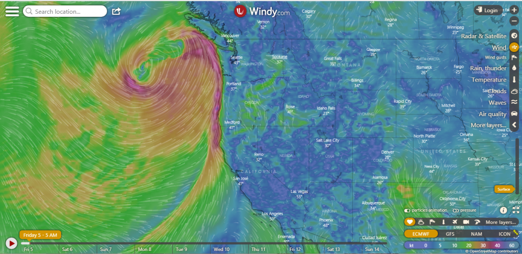
Reviewing data from each of these sources over a period of time gives you a clear picture of what to expect. Checking one against the other provides verification. If one source is saying something different, then dig deeper to determine if there is something you missed. Finally, talk to other boaters and especially the local Coast Guard. They are out there every day.
I particularly like the Windy app. I start with the macro view. For California coast conditions look at the map from Alaska to Mexico. This seems like a pretty big area. And, it is. But it will show you what the major influencers are for your area of travel. Then, start zooming in.
Watch For Trends
Which direction are the major trends moving? Are they increasing or decreasing in intensity? How are the macro trends affecting local conditions?
Correlate data from all sources and soon you will begin to understand what to expect under reported conditions for your route of travel.
Pick and choose sources at your own peril
Don’t fall into the trap of relying on your “trusted source”. I was on a crew that fell for this and it did not turn out well.
Our captain received a report that conditions for the crossing were favorable. They were not. And, we came to find out that he ignored warnings from other sources. If we were on any less of a boat I am sure we would not have survived. You can read about this misadventure in my previous post here.
Rounding Point Arguello Headed To Avila Beach
Good conditions rounding Point Conception continued as we rounded Point Arguello and headed to Avila Beach just north of Pismo Beach.
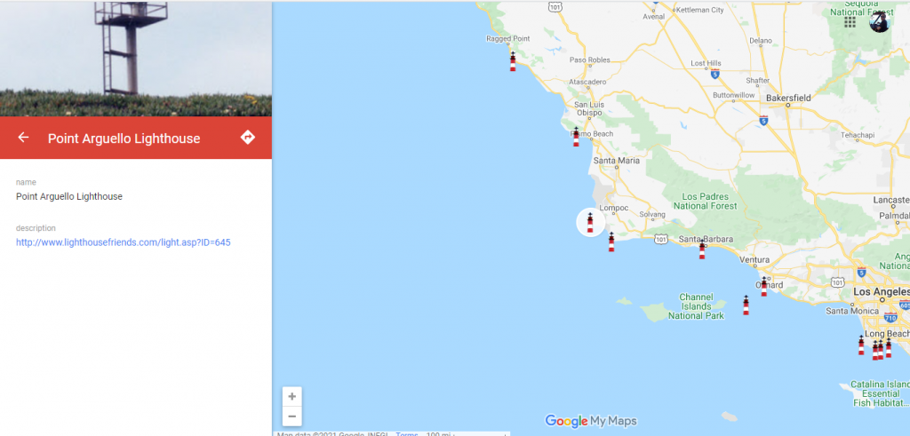
The same sea and weather conditions prevalent around Point Conception are present at Point Arguello. By the time we reached Point Arguello it was early afternoon and, although sea conditions were good we were noticing an increase in wave frequency. Nothing that Mai Tai couldn’t handle.
We, on the other hand, were beginning to tire. We’d been cruising for several hours now and were looking forward to a break. So, we decided to end the day anchored at Avilia Beach instead of going directly to Morro Bay.
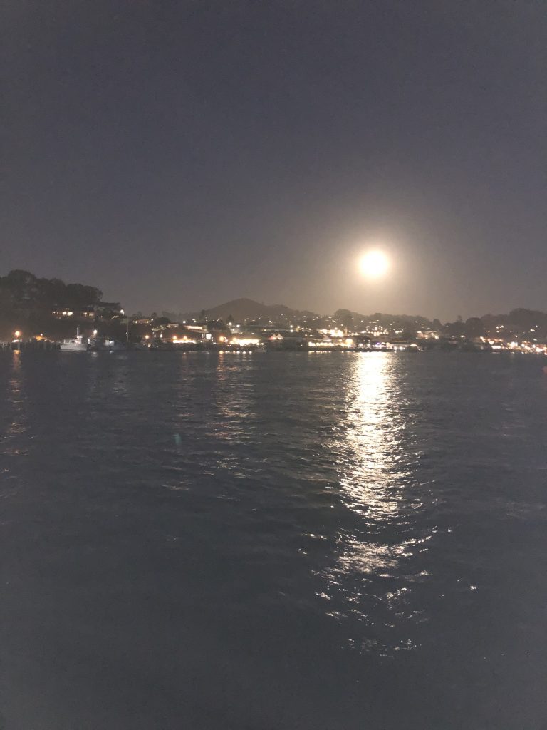
Avila Beach offers lots of room to anchor on the north side of the pier. Protection from surge was good and the sea bottom was good for anchoring. Boy were we happy to drop anchor and relax. It was a long day.
Something Slithers By Mai Tai At Dusk
Mai Tai’s first mate sounded the alarm! Something is in the water behind us, she exclaims. “It could be a swimmer trying to board us”. I came up on deck just in time to see something disappear in the water. We watched for several minutes and saw nothing more of the mysterious creature.
The mystery would be revealed the next day.
On To Morro Bay
Early the next morning we started our engines, weighed anchor and headed out to Morro Bay. Conditions were still perfect for this last leg of our journey for a few days.
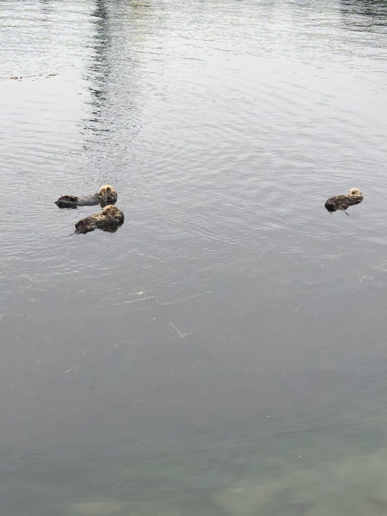
On our way we caught sight of whales and managed to capture a glimps of them and seals, too. We also solved the mystery of the night before.
Southern California, south of Point Conception has its share of whales and sea lions. But we never saw seals there. We also never saw sea otters. After seeing these little creatures swimming and playing we realized that the mystery guests the night before had to be otters playing.
Our trip from here to Morro Bay presented a variety of sea life. Including seals, sea otters and whales.
We had many whale sightings along our way but this was the closest and we actually captured some of it on camera. There are more little critters coming up as we approach Morro Bay. Apparently Morro Bay is a really popular place for sea otters.
Morro Bay Approach
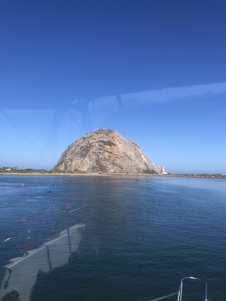
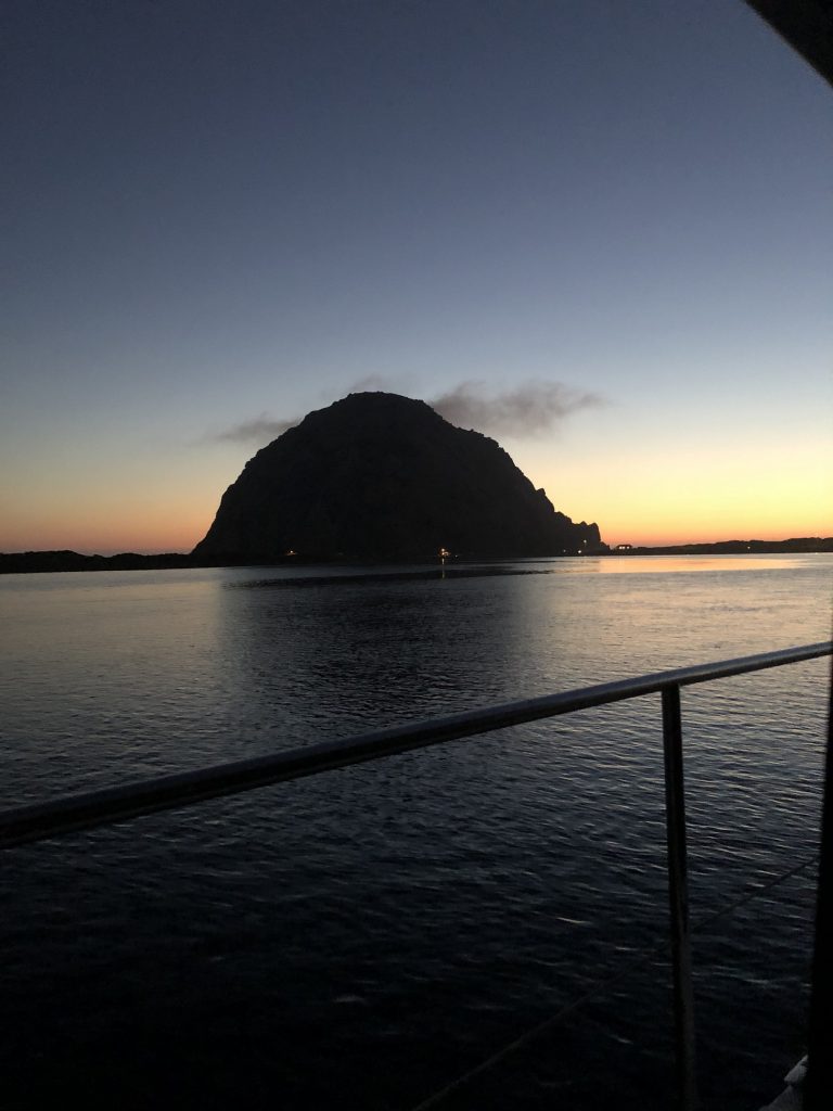
Visibility permitting, it is easy to make out the entrance to Morro Bay. Morro Rock is visible for miles and marks the entrance to the bay.
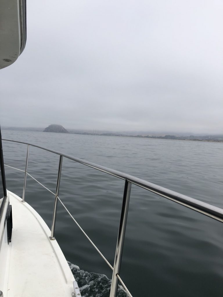
Sea conditions this morning were ideal. Visibility was overcast but visibility wasn’t to bad. Morro Bay is known as one of the foggiest spots on the California coast. We found the weather to be very mild and pleasant.
Morro Bay is a unique place offering something for everyone. We spent a few days exploring the area and town and I consider it one of my favorite destinations. From sandy beaches, beautiful views, quaint waterfront commercial district to paddle boarding and swimming.
The bay is very well protected. There is a free anchorage for transients. The harbor patrol will stop by and log your arrival time. You can stay for three days for free. After that you will have to pay. There is a buoy field for longer term stays.
There is no real marina. If there is space available you can tie up at the yacht club dock. The daily fee is on par with most marinas we visited.
I can’t end this story without including one of the most popular attractions . . . the Sea Otters!
These happy-go-lucky, fat little animals are everywhere here. They play and eat all day, swimming right alongside the paddle boarders. When they catch a fish, which they do all day, they roll over on their back and float while they munch on their catch.
There is so much to do, see and experience here that a few days is hardly enough time.
Next Stop, San Simeon
To join our expedition from the beginning Click Here
Recent Comments